 AlbertaSell
Central Heights
Includes Okotoks Drive and Lock Crescent on the municipal map.
Calgary region · Seller guidance
Okotoks maps neighbourhoods and business parks across part of the town. Start with the area containing your address, then compare similar property uses. An estate lot, an attached home and a business unit need different evidence of value.
Browse area guides ↓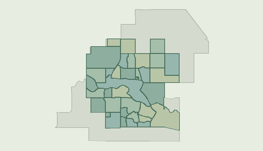
Includes Okotoks Drive and Lock Crescent on the municipal map.
Includes Cimarron Way and Cimarron Drive on the municipal map.
Includes Cimarron Estates Drive and Cimarron Estates Road on the municipal map.
Includes Cimarron Grove Close and Cimarron Grove Way on the municipal map.
Includes Cimarron Meadows Way and Cimarron Meadows Road on the municipal map.
Includes Cimarron Park Circle and Cimarron Park Close on the municipal map.
Includes Cimarron Springs Circle and Cimarron Springs Road on the municipal map.
Includes Cimarron Vista Way and Cimarron Vista Circle on the municipal map.
Includes Cimarron Common on the municipal map.
Includes Crystal Green Drive and Crystal Green Way on the municipal map.
Includes Crystal Shores Drive and Crystal Shores Road on the municipal map.
Includes Crystalridge Drive and Crystalridge Crescent on the municipal map.
Includes D'Arcy Ranch Drive and D'Arcy Boulevard on the municipal map.
Includes Downey Road and Welch Crescent on the municipal map.
Includes Milligan Drive and Drake Landing Common on the municipal map.
Includes Northridge Drive and North Railway Street on the municipal map.
Includes Hunter's Crescent and Hunter's Gate on the municipal map.
Includes Elizabeth Street and Mist Mountain Rise on the municipal map.
Includes Northgate Circle N and Northgate Boulevard E on the municipal map.
Includes Ranch Road and Ranchers View on the municipal map.
Includes North Railway Street and 32 Street E on the municipal map.
Residential / local property owner guidance for this mapped area.
Includes Mountain Street and Alcock Close on the municipal map.
Includes Sandstone Ridge Crescent and Sandstone Drive on the municipal map.
Includes Sheep River Cove and Sheep River View on the municipal map.
Includes Sheep River Drive and Sheep River Hts on the municipal map.
Includes Southbank Boulevard and Southbank Road on the municipal map.
Includes Suntree Lane and Sunset Crescent on the municipal map.
Residential / local property owner guidance for this mapped area.
Includes Carr Crescent and Hodson Crescent on the municipal map.
Includes Wedderburn Drive and Wedderburn Hts on the municipal map.
Includes Westland Street and Westmount Road on the municipal map.
Includes Westmount Pt on the municipal map.
Includes Southridge Drive and Westridge Drive on the municipal map.
Includes Woodhaven Drive and Woodburn Crescent on the municipal map.
For land outside the named neighbourhoods, start with parcel size, use, access and servicing. For a completed home, identify comparable size and construction within town.
Request a home valuationDiscuss a commercial saleOffer space for leaseDiscuss a land parcel